
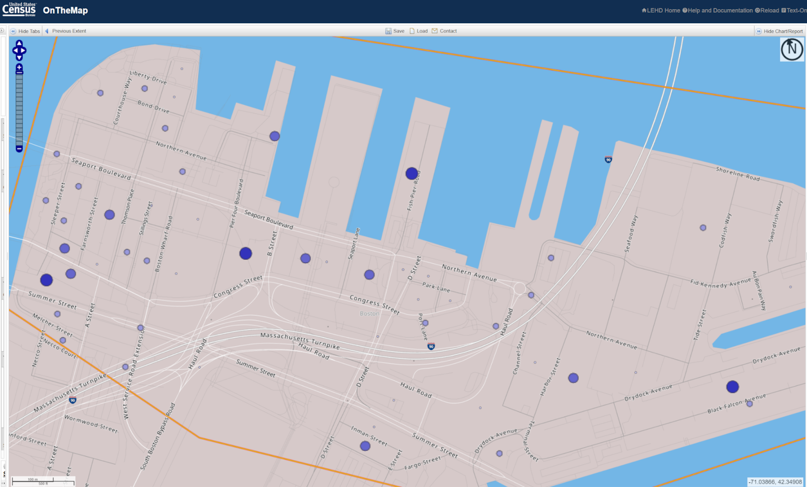
Here is the On-The-Map rendering of the Seaport (enhanced for legibility):
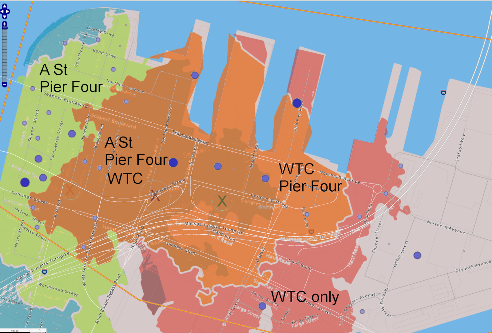
And here are the overlapping 10 minute walksheds of potential BRT stops on Congress St at A St, at Pier Four Boulevard, and in front of WTC station (note that the boundaries are not precise):
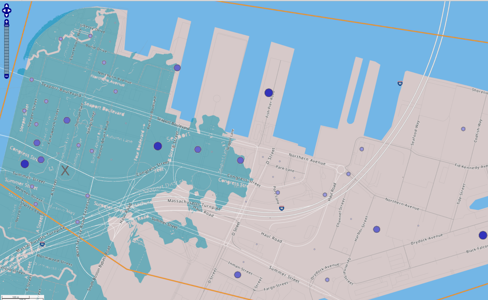
And for completeness, here is the A St walkshed on its own:
And WTC on its own:
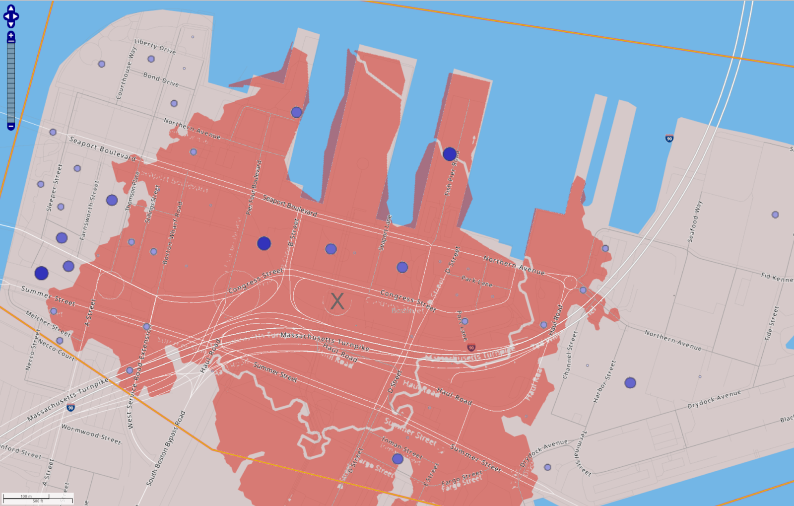
Somewhat surprisingly, WTC doesn’t actually net you that many more jobs (I think) – you get the WTC itself, that office building on D St, and some smaller job centers out near Silver Line Way and Northern Avenue, but it’s not as big of a difference as I expected.
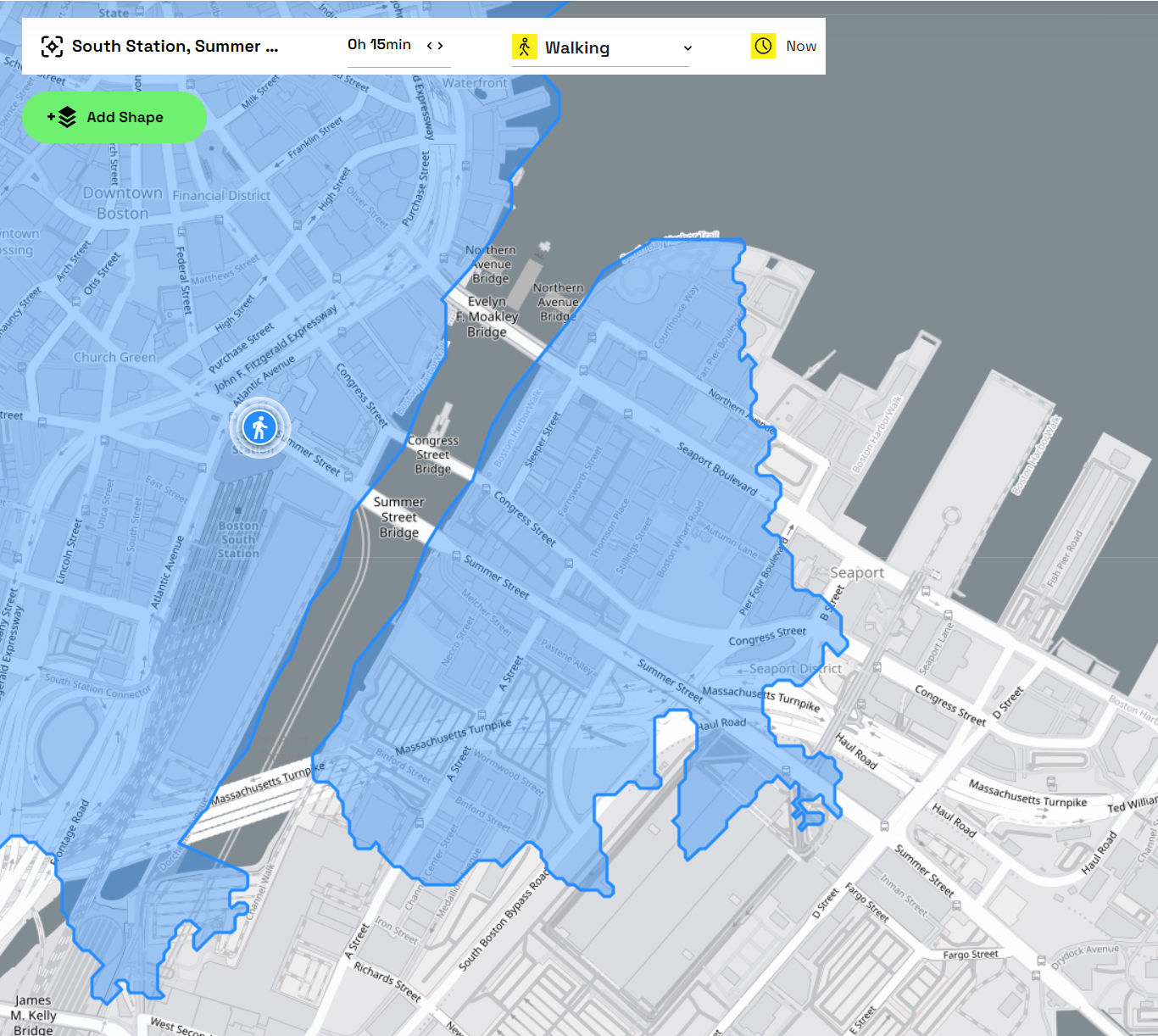
This exercise illustrates that the “center of gravity” of jobs in the Seaport is still probably closer to the western section rather than the eastern. This makes a fair amount of sense, given that the Western Seaport is still within a 15-minute walkshed of South Station:
Of course, the question for transit planners and crayon mappers: how much of the Seaport’s future development will be in the western half vs eastern?