Update, September 2024: These maps are now extremely out of date. ArchBoston user Delvin4519 has created a fantastic set of updated maps which should be referenced going forward.
Original content below, posted in September 2021 but written some time before that
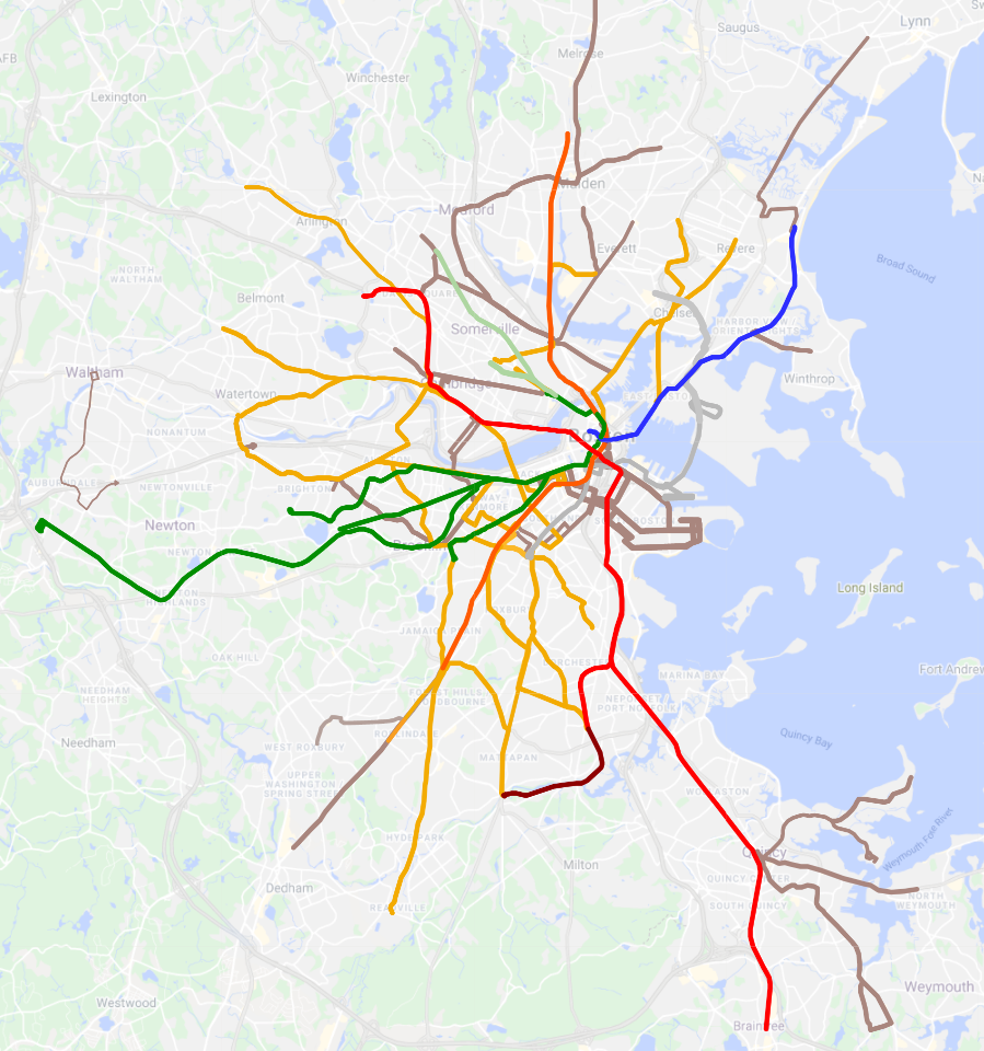
Over the course of 2020, I undertook an exercise to identify all MBTA bus services which run at “rapid transit frequencies” at some point during the day. (I chose to focus on pre-pandemic schedules, under the theory that eventually we would return to those levels.) Unsurprisingly, I made a map, which can be viewed on Google Maps: MBTA Subway + Frequent Bus.
(More detail on my methodology and strategy here on ArchBoston.)
At a high level, what I found was that there were two layers of frequent bus networks: those that were frequent all day and those that were frequent at peak only. I termed the all-day services as “Gold Line” services, and the peak-only services as “Bronze Line”.
Turning on and off the Bronze layer on the Google Map reveals how the MBTA’s network “breathes” over the course of the day, in and out of peak periods. During the height of rush hour, a comprehensive hub-and-spoke network emerges, which then fades away in the mid-day, only to return in the afternoon.
Additionally, more notably within the Bronze network, multiple “cumulative corridors” appear when you stack several modest-frequency routes on top of each other. Washington Street south of Forest Hills, or Broadway in Everett, are good examples of this phenomenon.
Additional analysis included in my original ArchBoston post here. A deep-dive on the Dorchester network is available here, though hopefully I will give that topic a post of its own at some point.
To my knowledge, there is no other map or analysis that examines this particular topic. (If I am wrong, please let me know! I’d love to see that!) So I hope this is useful, or at least of interest, to someone out there.
Taken altogether, this map gives a truer picture of where Greater Boston’s high-frequency than either the Key Bus Route system (which aligns somewhat but not entirely with the Gold network) or the MBTA Bus Map (which is useful, but overwhelming). Take a look: play around with turning on and off the different layers, click into individual corridors to see their frequencies and constituent routes, and let me know about any corridors I may have missed!