
(Eventually I may update this with nicer maps, but these seem useful enough for now.)
These are approximately the current locations of MBTA platforms in the stations surrounding the Financial District:
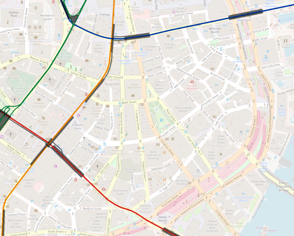
I’ve definitely made an attempt to make the platform lengths accurate, but they certainly are nowhere near 100% precise. The general layout and positioning should be pretty close to reality though.
At various points, I and others have imagined a new rail tunnel under Congress St. The 2018 North South Rail Link Feasibility Reassessment considered this alignment for mainline regional rail service and proposed a station spanning between State and Haymarket stations. I find this corridor more compelling for rapid transit service, which would entail slightly closer stop spacing.
As can be seen above, the distance between South Station and the Blue Line State station (“Devonshire” — using the old names is going to be relevant) is a little bit further than the typical downtown stop spacing, at about 2400 feet. For comparison, South Station <> Downtown Crossing is about 2000 feet, while Government Center to Boylston sees three stations in the space of 3000 feet (1500 feet between stations) and North Station <> Haymarket is about 1300 feet.
Is there enough space between South Station and Devonshire to merit an intermediate station? I think the argument can go either way, and it depends on how much you want to prioritize expanding the walkshed into the more remote corners of the Financial District. Note the gap in the current 5-min walksheds:
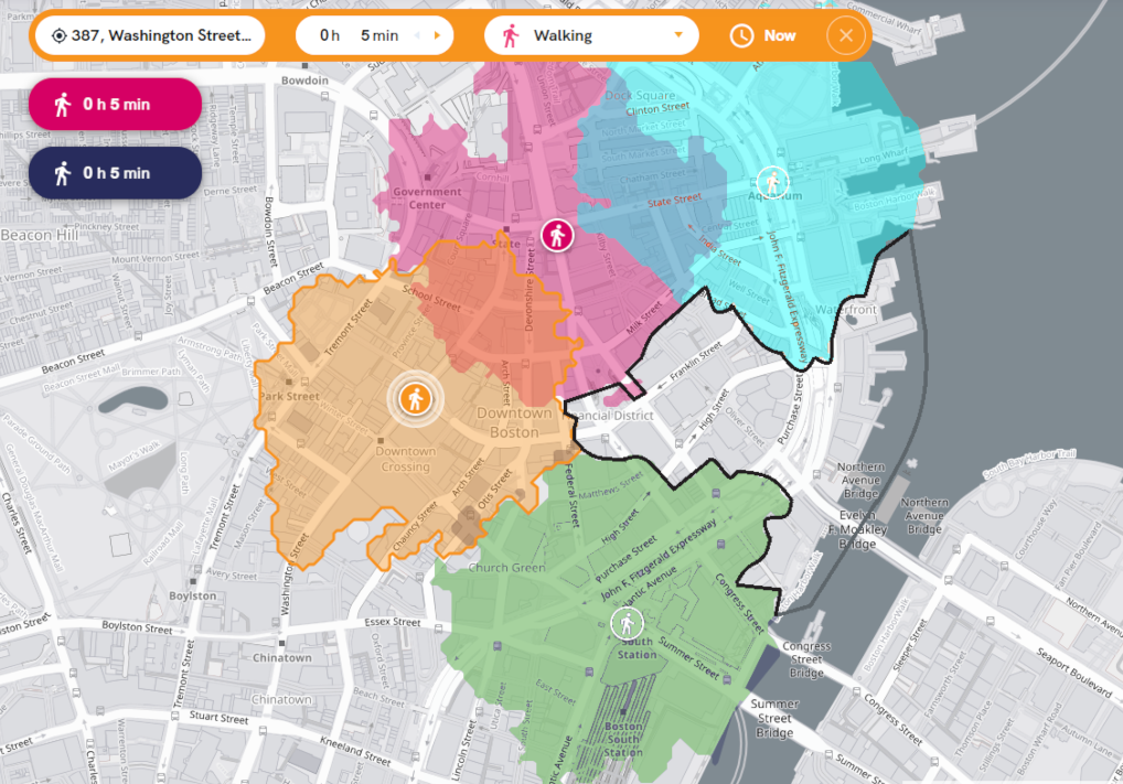
(Not shown is the additional walkshed from the southbound Orange Line platform at State — “Milk” — which expands the walkshed very slightly.)
An intermediate station along a Congress St Subway closes most (though not all) of the gap.
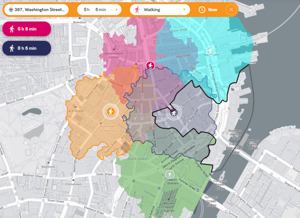
(Of course, if we expand our walksheds even just to the 8 minute mark, the entire Financial District becomes covered. So, the question of an intermediate station also depends on how much of a walk we want to ask of riders.)
If you build an intermediate station, it might look something like the below — a “Post Office Square” station centered on Franklin St, with a “State” or “State/Haymarket” station just north of the Blue Line:
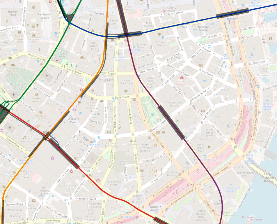
As you can see, I’d argue that a “Post Office Square” station subsequently requires some combining between stations north of the Financial District — either
- “State/Haymarket and North Station,” or
- “State and Haymarket/North Station”
(Or I guess you could do “State/Haymarket and North Station/Haymarket”, but that’s a separate question.)
Unless we are building a subway for LRT with 300-foot platforms, I don’t think you have spacing for all of:
- South Station
- Post Office Square
- State (Devonshire)
- Haymarket
- North Station
One alternative sees no intermediate station in the Financial District, but instead builds a platform centered on Milk Street, with connections to Devonshire and Milk stations:

In this alternative, you still get most of the walkshed expansion of the previous alternative, but without the expense (and time penalty) of an extra station.
(Looking at the diagram above, I would probably try to adjust the new station a little bit further north, though we are somewhat limited by the curve of the street above if we are trying to make straightaway platforms.)
The transfer to the Blue Line is a little long, but no longer than the current Milk <> Devonshire transfer. The Congress Subway <> Orange transfer is also long, but will be offset by a much better transfer to the north at Haymarket.
As it happens, this is very similar to what BERy proposed over 100 years ago, for their streetcar subway extension to Post Office Square.